Introduction - Siem Reap
Siem Reap province is located in northwest Cambodia. It is the major tourist hub in Cambodia, as it is the closest city to the world famous temples of Angkor (the Angkor temple complex is north of the city). The provincial capital is also called Siem Reap and is located in the South of the province on the shores of the Tonle Sap Lake, the greatest sweet water reserve in whole Southeast Asia. The name of the city literally means Siamese defeated, referring to the victory of the Khmer Empire over the army of the Thai kingdom in the 17th century.
At the turn of the millennium Siem Reap was a Cambodian provincial town with few facilities, minor surfaced roads and little in the way of nightlife. Tourism industry catered largely to hardy backpackers willing to brave the tortuous road from the Thai border on the tailgate of a local pick-up truck. There were a couple of large hotels and a handful of budget guesthouses. Tuk-tuks and taxis were non-existent and the trusty motodup was the chosen means of touring the temples of Angkor.
The proximity of the Angkorian ruins turned Siem Reap into a boomtown in less than half a decade. Huge, expensive hotels have sprung up everywhere and budget hotels have mushroomed. Property values have soared to European levels and tourism has become a vast, lucrative industry. The Siem Reap of today is barely recognizable from the Siem Reap of the year 2000.
Though some of the town's previous ramshackle charm may have been lost the developments of the last few years have brought livelihoods, if not significant wealth, to a good number of its citizens. This has been at a cost to the underprivileged people living within and beyond the town's limits that now pay inflated prices at the central markets and continue to survive on poorly paid subsistence farming and fishing. If Cambodia is a country of contrasts Siem Reap is the embodiment of those contrasts. Despite the massive shift in its economic fortunes, Siem Reap remains a safe, friendly and pleasant town. There is an endless choice of places to stay or dine and a host of possible activities awaiting the visitor.
 |
| Siem Reap map |
Geography - Siem Reap
Siem Reap province is 10,299 square kilometres big and definitely one of the most famous ones in Cambodia. It's located in the Northwest of the country bordering to the North with Oddor Meanchey, to the East with Preah Vihear and Kampong Thom, to the West with Banteay Meanchey and to the South with the biggest sweet water reserve in Southeast Asia, the huge Tonle Sap Lake.
The province in general, especially in the Southern part consists of the typical plain wet area for Cambodia, covering lots of rice fields and other agricultural plantations. The northern part is turning into an undulating area covered with some deeper, green forests. A quite distinguished mark of Siem Reap Province is the smaller, but important Siem Reap River. It rises from Phnom Kulen, meanders through the northern part of Siem Reap Province and eventually into the Tonle Sap Lake.
The province in general, especially in the Southern part consists of the typical plain wet area for Cambodia, covering lots of rice fields and other agricultural plantations. The northern part is turning into an undulating area covered with some deeper, green forests. A quite distinguished mark of Siem Reap Province is the smaller, but important Siem Reap River. It rises from Phnom Kulen, meanders through the northern part of Siem Reap Province and eventually into the Tonle Sap Lake.

Economy - Siem Reap
Generally spoken Siem Reap Province is all in all economically focusing on the foreign tourism due to the famous Angkor Temples. Since of the year 2000 the economical growth rate is gaining double-digits. It's all sub-sectors such as hotels, restaurants, bars, entertainment places and transportation to profit from the annual influx of tourists, which was in 2007 more than 1,000,000 people.
Except the tourism sector the provincial economy was and still is growing due to the enforced fishery. Thousands of tons are annually exported to other provinces within the country or outside Cambodia. Farming and fruit cropping has probably become a minor profitable sector, but is still done by the vast poor rural population, who are the underdogs regarding the annual provincial revenue.
Except the tourism sector the provincial economy was and still is growing due to the enforced fishery. Thousands of tons are annually exported to other provinces within the country or outside Cambodia. Farming and fruit cropping has probably become a minor profitable sector, but is still done by the vast poor rural population, who are the underdogs regarding the annual provincial revenue.
Angkor Wat temple

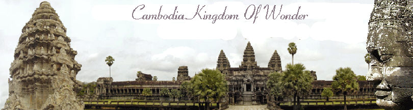
There are few places anywhere on earth to match the splendour of Angkor Wat. The temple is one of the largest monuments to religion ever built and is truly one the wonders of the world. Believed to have been constructed as a temple and mausoleum for King Suryavarman II at the peak of the Khmer empire in the first half of the 12th century, Angkor Wat is probably the best-preserved of the Angkorean temples. As with other Angkorean temples and walled cities such as Angkor Thom, the central theme of Khmer architecture revolved around the idea of the temple-mountain.
By the time building on Angkor Wat was begun early in the 12th century, this had been elaborated to a central tower surrounded by four smaller towers. The central monument represents the mythical Mount Meru, the holy mountain at the centre of the universe, which was home to the Hindu god Vishnu. The five towers symbolise Mount Meru's five peaks. It is difficult to express in words the enormous scale of Angkor Wat, but it can be explained in part by a look at the dimensions of the complex. The temple is surrounded by a moat which makes the one around the Tower of London, built at roughly the same time, look like nothing more than a garden trench.
At 190 metres wide and forming a rectangle measuring 1.5 km by 1.3 km, it is hard to imagine any attacking force overwhelming the defences. But the moat was more than just a defensive bulwark, in line with the temple's Hindu origins it represented the oceans of the world. A rectangular wall measuring 1025 metres by 800 metres borders the inner edge of the moat. There is a gate in each side of the wall, but unusually for the mainly Hindu-influenced Angkorian temples, the main entrance faces west. This entrance is a richly decorated portico, 235 m wide with three gates. However, the temple's greatest sculptural treasure is its 2 km-long bas-reliefs around the walls of the outer gallery and the hundred figures of devatas and apsaras. This intricately carved gallery tells stories of the god Vishnu and of Suryavarman II's successes on the battlefield. The whole complex covers 81 hectares.
Angkor National Museum

Visiting the Angkor National Museum was an eerie, surreal experience. For the first 45 minutes of our trip through the mammoth, 20,000-square-metre building, we didn't spot another visitor. The museum opened in November 2007, and its freshly painted, shopping mall-like feel contrasts with the thousands-year-old artefacts contained within it. A visit is a comfortable, air-con alternative to visiting the temples themselves, and a nice educational supplement to the history of Angkor if you visit the park without a tour guide. It's composed of eight separate galleries, all connected by a vaulted corridor with a series of fountains and lined with what seems like all the Angkorian limestone lion and demon heads missing from statues at the temples. After an explanatory film screening called Story behind the legend, you're pointed toward the galleries:
Gallery 1: 1,000 Buddha Images
This is the only gallery that's just one large room, rather than a series of maze-like alcoves, and the sight of all these Buddhas at once is striking. Hundreds of small and miniature Buddha figurines, made of metals, jewels and wood, all individually illuminated, line the walls here, identified according to the period they were made during and where they were discovered. In the centre, life-size and larger Buddha characters are displayed. The display includes Buddhas from Banteay Kdei, Bayon, Angkor Wat and Preah Vihear.
Gallery 2: Pre-Angkor Period: Khmer Civilisation
This gallery and all the subsequent ones combine mural-size explanations and short films through maze-like rooms explaining Angkorian history. The styles of figurines precede the trademark Angkor style, and there's a large collection of lingas, lintels and colonnettes.
Gallery 3: Religion and Beliefs
This room explains several of the most significant Hindu and Buddhist religious stories and folk tales depicted on Angkorian temples, including the most memorable Churning of the Sea of Milk carved into the rear wall at Angkor Wat. Carvings of Buddhist and Hindu religious figures are concentrated here as well.
Gallery 4: The Great Khmer Kings
The gallery focuses on King Jayavarman II, Yasovarman I, Soryavarman II and Jayavarman VII, those most responsible for Angkor's greatest constructions. Figures of the kings and relics from the temples they commissioned abound.
Gallery 5: Angkor Wat
There's a large film gallery inside this section of the museum. It features beautiful, panoramic images of the temple and explanations of how it was constructed. There are also many restored figures from the temple itself as well as post-Angkorian wooden statues used for worship at the temple until several hundred years ago.
Gallery 6: Angkor Thom
In addition to recovered artefacts from Angkor Thom, this gallery includes a history of and artefacts from the vast irrigation projects commissioned by the king who built Angkor Thom with his smiling face looking out from every tower: Jayavarman VII.
Gallery 7: Story From Stones
This room is one of the most interesting. It's a collection of stone pallets with ancient Khmer and Sanskrit inscriptions. The writing on each slate is explained on placards below. The writing on them includes the declaration of the construction of a new hospital, lists of slave names, mediations of land disputes and adulations of kings and gods.
Gallery 8: Ancient Costume
From Apsaras and kings to princesses and warriors, this room contains the busts and statues of distinct fashions and styles as they evolved throughout Angkor time. There's also a collection of ancient jewellery and headdresses. It's a clever segue to the final room -- the gift shop -- where upscale imitations of these fashions abound.
It's $12 to enter the museum, plus another $3 if you want to bring in your camera and another $3 for an educational headset. Sadly, like ticketing and management of the Angkor park, the museum is owned and run by a private company, so little of your admission money goes to Cambodia or to temple restoration (though what the company paid for the concession might). Still, it's perhaps better than these artefacts remaining in the hands of private collectors. A connected mall is still under construction but has a few open stores, including a Blue Pumpkin satellite, several souvenir shops and the sure sign of apocalypse.
Bakong Temple

Bakong is located at Roluos south of Preah Ko. Enter and leave the temple at the east. A modern Buddhist temple is situated to the right of the east entrance to Bakong. It was build in late ninth century (881) by king Indravarman I dedicated to Siva (Hindu) followed Prah Ko art style.
BACKGROUND
Bakong was the center of the town of Hariharalaya, a name derived from the god Hari-Hara; a synthesis of Siva and Visnu. It is a temple representing the cosmic Mount Meru. Four levels leading to the Central Sanctuary correspond to the worlds of mythical beings (Nagas, Garudas, Raksasas and Yaksas).
LAYOUT
The temple of Bakong is built on an artificial mountain and enclosed in a rectangular area by two walls. It has a square base with five tiers. The first, or outside, enclosure (not on the plan) (900 by 700 meters, 2,953 by 2,297 feet) surrounds a moat with an embankment and causeways on four sides, which are bordered by low Naga balustrades. The second and smaller enclosure (1) has an entry tower (2) of sandstone and laterite in the center of each side of the wall. There were originally 22 towers inside the first enclosures. After passing through the entry tower at the east one comes to a long causeway (3) decorated with large seven-headed serpents across a moat. Long halls (4) on each side lie parallel to the eastern wall. They were probably rest houses for visitors. Two square-shaped brick building at the northeast and southeast (5) corners are identified by rows of circular holes and an opening to the west. The vents in the chimneys suggest these buildings served as crematoriums. There was originally a single building of this type at the northwest and southwest corners but today they are completely ruined. On each side of the causeway just beyond the halls there are two square structures with four doors (6). The inscription of the temple was found in the one on the right.
Further along the causeway, there are two long sandstone buildings (7) on each side, which open to the causeway. These may have been storehouses or libraries. To the north and south of the storehouses receptively there is a square brick sanctuary tower (8). There are two more on each side of the central platform, making a total of eight. Decoration on the towers is in brick with a heavy coating of stucco. The towers, with one door opening to the east and three false doors, have a stairway on each side, which is decorated with crouching lions at the base. The two to the east of the central platform have a unique feature, a double sandstone base, The door entrance and the false doors were uniformly cut from a single block of sandstone, The decoration on the false doors is exceptionally fine, especially that on the tower on the right in the front row, the false door of which has remarkable Kala handles. The corners of the towers are decorated with female and male guardians in niches.
Tip:
the lintels of the west towers are in the best condition. A long building with a gallery and a porch opening to the north (9) is situated close to the western wall (on the left); it is mostly demolished.
CENTRAL AREA (BASE AND TOWERS)
The square-shaped base (10) has five tiers with a stairway on each of the four sides and, at the base, a step in the shape of a moonstone. Remains of a small structure can be seen at the base of the stairway fairway flanked by two sandstone blocks, which may have held sculpted figures.Elephants successively smaller in size stand at the corners of the first three tiers of the base. The fourth tier is identified by twelve small sandstone towers, each of which originally contained a linga. The fifth tier is framed by a molding decorated with a frieze of figures (barely visible) the ones on the south side are in the best condition.
CENTRAL SANCTUARRY
The Central Sanctuary (11) is visible from each of the five levels because of the unusual width of the tiers. The sanctuary is square with four tiers and a lotus-shaped top. Only the base of the original Central Sanctuary remains. The rest was constructed at a later date, perhaps during the twelfth century.
LOLEI
Location: Lolei is at Roluos, north of Bakong. A modern Buddhist temple is located in the grounds of Lolei near the central towers. Access: Enter and leave the temple by the stairs at the east.
Tip:
Beware of the ants during certain seasons near the top of the entrance steps. Date: End of the ninth century (893) Religion: Transitional between Prah Ko and Bakheng
BACKGROUND
Although Lolei is small it is worth a visit for its carvings and inscription. The temple of Lolei originally formed an island in the middle of a Baray (3,800 by 800 meters, 12,467 by 2,625 feet), now dry. According to an inscription found at the temple the water in this pond was for use at the capital of Hariralaya and for irrigating the plains in the area.
LAYOUT
The layout consists of two tiers with laterite enclosing walls and stairway to the upper level in the center of each side. Lions on the landings os the stairways guard the temple. A sandstone channel in the shape of a cross situated in the center of the four towers on the upper terrace is an unusual feature, the channels extend in the cardinal directions from a square pedestal for a linga. It is speculated the holy water poured over the linga flowed in the channels.
CENTRAL SANCTUARIES
Four brick tower with tiered upper portions, arranged in two rows, on the upper terrace make up the Central Sanctuaries. As the two-north towers are aligned on the east-west axis, it is possible the original plan had six towers, which probably shared a common base like that at Prah Ko.
Tip:
The northeast tower is the best preserved.The entrances of the doors to the towers are cut from a single block of stone, as at Bakong. The corners of the towers on the east are decorated with male guardians holding tridents and those of the west with female divinities holding flywhisks. They are sculpted in sandstone with a brick casing. The panels of the false doors have multiple figures. The inscriptions on the doorframes are exceptionally fine. The workmanship on the lintels is skilled and the composition balanced. Some noteworthy depictions are: Indra on an elephant with figures and Makaras spewing serpents (northeast tower); Visnu riding a Garuda with a branch of serpents (south-east tower).
Baksei Chamkrong

The bird that shelters under its wings. This little temple with its four square tiers of laterite, crowned by a brick sanctuary, might serve for a model in miniature of some of its giant neighbors, and is almost as perfect as perfect as the day it was built...
Prasat Baksei Chamkrong is located 150 meters (492 feel) north of Phnom Bakheng and 80 meters (262 feet) from the road leading to the south gate of Angkor Thom. A visit to Baksei Chamkrong can be combined with a stop at the south gate of Angkor Thom. Enter and leave the temple from the east entrance.
Tip: The stairs to the Central Sanctuary are in poor condition but the architecture and decoration of this temple can be viewed by walking around it (in a clockwise direction). Those who persist in climbing to the Central Sanctuary should use the north stairway. It was built in middle of the tenth century (947), perhaps begun by Harshavarman I and completed by Rajendravarman II, dedicated to Siva (Hindu) may have been a funerary temple for the parents of the king with following transitional between Bakheng and Koh ker
BACKGROUND
According to legend, the king fled during an attack on Angkor and was saved from being caught by the enemy when a large bird swooped down and spread its wings to shelter the king. The name of the temple derives from this legend.
Baksei Chamkrong was the first temple-mountain at Angkor built entirely of durable materials brick, laterite and sandstone. Even though it is small the balanced proportions and scale of this monument are noteworthy. Inscriptions on the columns of the door and the arches give the date of the temple and mention a golden image of Siva.
LAYOUT
Baksei Chamkrong is a simple plan with a single tower on top of a square tiered base with four levels of diminishing size (27 meters, 89 feet, a side at the base) built of laterite (1-4). The height from the ground to the top of the Central Sanctuary (7) is 13 meters (43 feet). Three levels of the base are undecorated but the top one has horizontal molding around it and serves as a base for the Central sanctuary. A steep staircase on each side of the base leads to the top. A brick wall (5) with an entry tower (6) and sandstone steps enclosed the temple. Although it has almost all disappeared vestiges are visible on the east side of the temple.
CENTRAL SANCTUARY (7)
The square central tower is built of brick and stands on a sandstone base. It has one door opening to the east with three false doors on the other sides. As is typical of tenth-century Khmer architecture, the columns and lintels are made of sandstone. A vertical panel in the center of each false door contains motifs of foliage on stems. The interior of the tower has a sunken floor and a vault with a corbel arch.
The finely worked decoction on the sandstone columns and horizontal beams above the doors imitates woodcarving. An outline divinity can be seen in the bricks at the corners of the tower. A three-headed elephant on the east lintel is finely carved.
Banteay Kdei
The citadel of the cells . In the ruin and confusion of Banteay Kdei the carvings take one's interest. They are piquant, exquisite, not too frequent... they seem meant.. to make adorable a human habitation.
Banteay Kdei is located south of Ta Prohm. A enter the monument from the west and leave at the west or vice versa, either way, also visit Srah Srang.
It was built in middle of the 12th century to the beginning of the 13th century by king Jayavarman II in Mahaya Buddhism with following at least two different art periods Angkor Wat and Bayon -are discernible at Banteay Kdei.
BACKGROUND
Banteay Kdei has not been restored and allows the visitor to experience what it may have looked like originally. Changes and additions account for is unbalanced layout. Banteay Kdei was built of soft sandstone and many of the galleries and porches have collapsed. The wall enclosing the temple was built of reused stones. LAYOUT
The temple is built on the ground level use as a Buddhist monastery. The elements of the original design of Banteay Kdei seem to have been a Central Sanctuary (5), a surrounding gallery (6) and a passageway connected to another gallery. A moat enclosed the original features of the temple. Another enclosure and two libraries were among the additions in the Bayon period. The outer enclosure (700 by 500 meters 2,297 by 1,640feet) is made of laterite (1) and has four entry towers.
A rectangular courtyard to the east is known as 'the hall of the dancing girls', a name derived from the decoration which includes dancers (2) The entry tower of the second enclosure (3) is in the shape of a cross with three passages; the two on either end are connected to the literate wall of the enclosure (4) 320 by 200 scrolls of figures and large female divinities in niches. In the interior court there is a frieze of Buddha.
A causeway of a later date, bordered with serpents, leads to the entry tower of the third enclosure. It comprises a laetrile wall (6) includes a gallery with a double row of sandstone pillars that open onto a courtyard. Tip Parts of this area have been walled in and passage is limited. Vestiges of the wooden ceiling can still be seen in the central Sanctuary. The galleries and halls, which join it in a cross to the four entry towers, are probably additions. Two libraries (7) open to the west in the courtyards on the left and right of the causeway.
Banteay Sam Re
Banteay Sam Re located at Preah Dak commune, Bon Tiey Srey District by Charles De Gaulle Road via Angkor Wat in 16-kilometer distance from the provincial town of Siem Reap.
This temple is somewhat islocated, and you should be vigiland of your possessions and travel with a local guide. The temple is worth the extra effort to experience the elaborate architecture, and fine carvings, although theft has mutilated many of the temple's treasures.
Location: 400 meters (1,312 miles) east of the East Baray Access: enter and leave Banteay Samre from the east.
Date: middle of the 12th century
King: Suryavarman II (reigned 1113-1150)
Religion: Hindu (dedicated to vishnu)
Art Style: Angkor Wat BACKGROUND
Banteay Samre is one of the most complete complexes at Angkor due to restoration using the method of anastylosis. Unfortunately, the absence of maintenance over the past 20 years is evident. The name Samre refers to an ethnic group of mountain people, who inhabited the regions at the base of Phnom Kulen and were probably related to the Khmers. No inscription has been found for this temple, but the style of most of the architecture is of the classic art of the middle period similar to Angkor Wat. The monument most likely dates from the same period, or, perhaps, slightly later, although there are additions attributed to the Bayon style. The proportions of Banteay Samre are plended. A unique feature is an interior moat with laterite paving, which when filled with water must have given an ethereal atmosphere to the temple. All of the buildings around the moat are on a raised base with horizontal mouldings, decoreated in some areas with figures framed by lotus buds.
Banteay Srey Temple

Location: 25 kilometers (15.5 miles) north-east of East Mebon
Access: enter and leave the temple by the east entrance
Date: second half of the 10th century (967)
King: Rajendravarman II (reigned 944-968) and Jayavarman V (reigned 968-1001)
Religion: Hindu (dedicated to Shiva)
Art style: Banteay Srei
Access: enter and leave the temple by the east entrance
Date: second half of the 10th century (967)
King: Rajendravarman II (reigned 944-968) and Jayavarman V (reigned 968-1001)
Religion: Hindu (dedicated to Shiva)
Art style: Banteay Srei
The Banteay Srei temple was built by a Brahmin priest Yajnavaraha with his younger brother. Thid temple was dedicated to the Siva god. That’s why at the originally this temple was given name as “Isvarapura” which mean “The city of Siva
The entrance tower was decorated with Indra who is the god of rain and the king of heaven riding on the three headed of elephant named Aravata. And below is the face of Kala, he was a guardian of above the door. And at the edge of the pediment, they designed the Naga with three heads whose comes out from the mouth of Makara was the mythical sea animal, which his body liked a snake and his head liked the lion. On the frame of the door, there are the octagonal balusters which decorated carving so elaborated. This entry tower used the timber to build the roof. We notice that on this structure also have two windows and five columns, because the monument from the early period. The Khmer monument temples were share similarity of its designed style. For example at the beginning, they built the entry tower and behind the tower of the entrance, there is a walkway leading to second entrance and then another causeway leads direct to the main structure where was the religious area. This concept was significant of the connection between the three worlds, including underworld to the world and to the heaven.
The first walkway of Banteay Srei is 67m long which flanking by the 34 stone lanterns on the each side. This causeway is paved by the laterite. On the each side of this walkway, there were the halls for taking a rest by the pilgrims, but today it remained only some stone pillars and its walls built of Lava stone. In the midway of this area, if you turn on the right you may see a structure with emty roof, but pediment excellent carving of Narasingha is turning the chest of Haranyakashipu. And the mythical lion with elephant trunk whose coming out the mouth of Makara at the edge. The opposite one on the south, this building is bigger, which its lintel depicting the god Siva riding on Nandin with his below wife Pavati. At the below the bull, you will see the Kala face again, and Garuda, Naga, Makara and the side of its pediment. There is a pediment on the ground which the French did not have time to restore, is depicting the story of Ramayana, which one in the middle of the scene, Ravana the demon king abducted Sita and fly a way to his palace. Those structure are located in this area were also served as the rest house. The end of this walkway we can see the second Gupura, which at the door frames, there inscription which are still good condition. From this writing tells us about the purpose of the temple, the history and the foundation of religion under king Jayavarman V.
This section, there is an enclosing wall built of laterite which one it measures 90m x 110m and there is a moat surrounding the main area of the temple. And then on the mouth of this moat next to the wall, you can see the pile of rock which they just gathered for in case of next time restoration, which one piece is from the lintel and it has beautiful carving which depicted the Brahma the creator riding on the goose. There is also another short walkway crossing the moat leading to the entrance of the main structure. This entry tower designed so distinctive which we never seen such extraordinary ornamentation like this in around the temples of the Angkor Wat. They adorned with double entrances, with its beautiful spiral like a shape of conch shell and on the top decorated the shape of the demons and the flame of fire emerged to the top. But as unfortunately the flame of fire had been stolen in 1993, so it remained only the second one. At the lintel of the inner or the second entrance building, they decorated Laksmei the goddess of beauty and the chief of the Apsara dancers and the mother of Kamashutra the god of loves, is being pouring the holy water from the two white elephants bring the coronation when herself just emerged from the milky sea and ready to get married to Vishnu. That’s why we see the Garuda (Vishnu mount) is below to carrying her to the Vishnu palace in mountain Meru.
And the third Gopura, there is another enclosing wall, which it measure 38m x 42m and when we enter to this section you will see the structure which they built surrounding the main tower, they were served as the rest house as well, but the roof had gone, because its perished wood. There is a statue of bull Nandi lying on the courtyard, but unfortunately this statue had been destroyed and poor condition. The opposite of bull statue on the lintel of the fourth Gopura is depicting the Siva dancing for destining of the world. On behalf of himself as the destroyer and generator, Siva must dance for creating the season and recycle all the life of three worlds. Here we can the wall built of brick, but today is ruined, but remained its trace, which its side was 24m x 24m. In this wall, there are two libraries which one the real door facing to the west. On the pediment of the south library the relief are depicting the story of Ravana shaking the mountain Kailasa where the home of Siva. Every one on the palace were shocking because they thought the earthquake occurred, but only Siva he ha known the reality, and then he presses his toes down for protection, that causing the mountain Kailasa fell down and crushed Ravana underneath. Ravana was not able to move and then he beseeched the lord Siva to let him out as promising for 1000 years stop coming to make in trouble. Siva agreed and even he gave a sword as present for Ravana. From then on Siva fell confidence for his meditation.
On the west lintel of the south library is depicting the god of love (Kamashutra) shooting an arrow which he made from one hundred different of flowers to the heart of Siva for making him to love his wife Pavati. Because Siva had been forgotten to make a honeymoon for three years. That’s why Pavati granted Kamashutra to help for attractive her husband from his meditation. And at the lintel of the north library part east, is depicting the Indra god of rain and king of the heaven who riding on the three headed elephant is being offering the rain water to the earth, that made the people, animals, birds even the jungle look happy and fresh. In the carving, you see the waving lines is mean the cloud and the lines coming down are the drop of the rains. On the west lintel of the north library is the story of the Mahabarata, which from the chapters of Krisna the eight reincarnation of Vishnu is taking his revenge to his tyrant uncle king Kamsa who when he was so young executed his parents. After the killing, he through the body of Kamsa to the down stair, and causing his concubine were shocking and weeping. And if you go round to the west Gopura, you may see the beautiful lintel with its intricate details into the yellow sandstone, and at the upper part of the pediment is depicting the two monkeys who was a twin are being struggle, and later Rama came to interfere and help the younger Sogriva as shooting an arrow to kill the older or named Vatin.
The central tower of Banteay Srtei, there are three towers which represented to the trinity of the Hinduism. The middle tower was dedicated to Siva which at the doorway was guard by the man. On the north tower was dedicated to Brahma, the creator god, which at the door protected by the lion-man as the guardian. And on the south, this shrine dedicated to Vishnu the protector, at his shrine door was guarded by Garuda. All the guardians of three gods were reproduction the original kept in the national museum, and some are in the Angkor conservatory. The female divinities adorned in this tower are unique one, as she stand in the sway shape rather than the frontal position in Angkor Wat and Bayon for example. The main tower for the Siva was adorned with the main divinities. The for Apsaras in this area were stolen by André Malraux in 1923, but he was arrested, and decided removing these sculptures and then Mr. Hanri Marchal took them in the same places. Some of the Apsaras of this area also had been defaced by a Vietnamese solder in 1985. Banteay Srei temple is considered as the gem arts in the Khmer civilization. Most of visitors feel in deep appreciation by its special workmanship.
Baphuon

This temple built by Udayadityarvarman II was the most poorly constructed of all the temples in Angkor. From the remaining ruins, it is possible to see how imposing it was. This temple hill was dedicated to Shiva, but in its reliefs many motives from the Vishnu epic can be seen. Restoration work continues to be carried out on the Baphuon. North o f the Golden Tower [Bayon]. rises the Tower of Branze [Baphuon] higher even than the Golden Tower : a truly astonishing spectacle , with more than ten chambers at its base. Prasat Baphuon is located 200 metres (656 feet) northwest of the Bayon and south of Phimeanakas. A enter and leave at the east.
Tip: Access to the summit is difficult as much of the temple has collapsed and it is overgrown but for those stalwarts who want to go to the top, use the way with columns at the east and the temple of Phimeanakas on the left. Visitors should walk down the causeway, climb the steps to the first tier, turn left and walk around the temple, always keeping it on their right. It was built in middle of the 11th century (1060) by king Udayadityavarman II, dedicated to Siva (Hindu) with following Prasat Baphuon.
BACKGROUND
The grandeur of Baphuon as described above by Zhou Daguan is unrecognizable today because of the poor condition of the temple. The French were in the process of restoring this temple when they were forced leave Angkor in 1972 because of war. Baphuon is situated inside the royal city of Angkor Thom but dates from the eleventh century and was built before the city was established. An interesting feature of Baphuon are the bas-reliefs which are scenes carved in small squares.Unfortunately few of these are visible because of the poor state of the temple. The narrative themes are realistic depictions of daily life and forest scenes.
LAYOUT
Baphuon is a single sanctuary temple-mountain situated on a high base. It is a symbolical representation of Mount Meru. A rectangular sandstone wall measuring 425 by 125 metres (1394 by 410 feet) encloses the temple (1). A long sandstone elevated approach (200 metres, 656 feet) at the east entrance (3) forms a bridge to the main temple. It is supported by three rows of short columns.
Tip:
Before walking down the approach turn left at the east entry tower (2) and walk to the end of the gallery for a superb view of a four-faced tower of the Bayuon framed by a doorway of Baphuon. The approach is intercepted by a pavilion in the shape of a cross (4) with terraces on the left and right sides. Turn left and walk to the opening the approach. Continue to the view of the arrangement of the imposing pillars under the approach. Continue to the end of the gallery to see a rectangular paved pool (5).
The temple stands on a rectangular sandstone base with five levels that are approximately the same size, rather than the more common form of successively smaller levels. The first, second and third levels are surrounded by sandstone galleries. Baphuon is the first structure in which stone galleries with a central tower appear. Two libraries (6) in the shape of a cross with four porches stand in the courtyard. They were originally connected by an elevated walkway supported by columns.
The gallery of the enclosure collapsed and, at a later date , the stones from it were modeled into the shape of a reclining Buddha (7) that spans the length of the west wall ( the head is on the left, facing the temple) . It is an abstract form and the outline of this Buddha is difficult to distinguish. A stairway (8) leading to the summit begins in the middle of the Buddha. The top level is in poor condition due to several collapses. Originally there was a Central Sanctuary with two wings. Each side of the entrance to the Central Sanctuary is carved with fine animated figures. If you look carefully you can see these from the ground on the west side.
Tip:
The view from the top with Phnom Bakheng in the south and Phimeanakas in the north is magnificent.
 Beng Mealea was built in middle of the 12th century, with later additions in the reing of the SuryavarmanII with the style of Agnkor Wat and dedicated to Hinduism.
40 km due east from Angkor Wat. Take the road to Banteay Srie, but at the fork 2 km before Banteay Srei (31 km from the Grand Hotel, Siem Reap and 17.5 km from the village of Phum Pradak) take the right fork.
Continue for 8 km and at the crossroads turn right. After anther 26 km you reach a T-junction; turn left hear and after 11 km you reach the south gate of the temple. Enquire about the condition of the road before setting out; it may be impassable in the wet season and certain makeshift bridges may be unsafe. A total of 77 km from Siem Reap.
Though unrestored, and in a fairly ruinous state, the large temple of Beng Mealea ('Lotus Pond') some 40 km due east of Angkor on the ancient royal way to the 'great Preah Khan' of Kompong Svay (another 60 km further on), is one of the major monuments of the classical period, in the style of Angkor Wat and roughly contemporary with it. Whoever built it must have been a figure of some importance, but he remains unknown,
as no inscriptions have been found here, and no other that mentions it.
Its position was strategic, where the royal way to Koh Kerin the NE forks from the road E to the 'great Preah Khan', and also at the head of a canal that leads directly to the Great Lake, down which sandstone blocks from the nearby quarries could have been floated on their way to Angkor.
 Its chaotic state, with collapsed galleries and towers (the central sanctuary is virtually a pit, with no superstructure whatsoever) may be due to a variety of causes. The most important is simply the wear and tear of eight and a half centuries in a tropical climate, with the spread of vegetation, including the silk-cotton tree and strangler fig, going to work on some ambitious vaulting which was being tried out here and at Angkor Wat for the first time. It is not known whether there was any iconoclasm, a possibility whenever there is evidence of different faiths practised, as here. Happily, there is no evidence of recent looting. There is a considerable disorder, but very romantic for all that. Many of the early French scholars thought highly of this temple for both its architecture and its decoration. Coedes made a special study of its carving, and Groslier considered it to be a prototype, with a "harmony, powerful and sober". Its history is completely unknown, and it can be dated only by its style, which is of the mid-12th century. Beng Mealea was built of blue sandstone from local quarries, and while there are no narrative bas-relief panels as at Angkor Wat, there is a fair amount of decoration on walls and pilasters, all of a high standard, as well as apmras, lintels and few pediments. The religious history is also unknown, with carvings showing legends of Vishnu, Shiva and the Buddha.
The temple marked the centre of a town, surrounded by a moat 1025m by 875m, and 45m wide. Four paved avenues lead via cruciform terraces to the entrances at the cardinal points, and it is oriented to the E. Directly to the E of the complex is a large baray, with a small island containing a shrine in its centre, as usual. In plan, Beng Mealea reminds one of of Angkor Wat, though all at ground level with no temple mountain. There are three concentric enclosures, each one set back slightly to the west, with the central shrine at the intersection of the axes (and so the intersection of the town's avenues as well). These enclosures are tied together with 'cruciform cloisters', just as at Angkor Wat, and in the NE and SE corners of the enclosures are shrines of the kind known wrongly as 'libraries'. Also as at Angkor Wat, Beng Mealea has some impressive stone vaulting, and half-vaults that work as a kind of buttressing.
Without the ample space that there is at Angkor Wat, all these interconnecting galleries would be confusing enough, even if the temple were in a restored condition. In addition, however, there have been additions, such as the raised causeways and probably the cruciform terraces, possibly also the two large galleried structures that fill the space between the second and outer enclosures on the south side. In its present state this last is a warren of stone and vegetation.
Unlike Ta Prohm's controlled 'wild' state where the undergrowth is cut back, Beng Mealea is genuinely uncleared - the real thing for would-be explorers. You will need the services of a local guide, which is to say one of the villagers, and by the end of the visit you will be happy to pay for being taken around the tortuous route. This involves clambering through small spaces and along roof tops, although in time this may become restricted as access comes under the control of the Angkor authorities.
The state of the temple means that access is not by the obvious routes, and there are several ways of visiting. The route given here has been worked out by local guides, and shows most of what is interesting. Begin at the S gate of the outer enclosure, a short walk or drive from the road. Walk east along the outside of the wall to the SE corner pavilion. Here is excellent decorative carving on the walls, and a group of devatas, very clearly in the style of Angkor Wat, with stylised large folds of the sarong flying out left and right from above the belt. The expressions of these girls is particularly serene, and one is, unusually, cupping her bare breast (the guides never fail to point this out).
Continue around the outside 'of the E side, to the cruciform terrace, raised on circular columns, with the remains of naga balustrades. The rearing five-headed nagas are magnificent and elaborately decorated, each with a proboscis and all tied together with a large, arrow-like halo. The route continues past the NE corner pavilion and round to the north side, where several metres beyond it is easy to clamber over. Here you face one of the raised 'libraries'. Walk left around this to the end of the small raised causeway that connects it to the' cruciform cloister'. For once, it is possible to use a doorway; once through, turn right and head W into the second enclosure, following the ledge on the inside of the gallery.
Enter the gallery of the inner enclosure a few steps S of the corner. On your left is the barely recognisable shrine and its vestibule, with a fallen lintel showing the Churning of the Sea of Milk. It is possible to walk around the upper part of the shrine, as the tower has completely collapsed. From here it is necessary to clamber southwards and up onto the roof of the N-S axial gallery. On either side as you walk there are views of the additional southern complexes. Descend to the left and enter a dark but impressive long vaulted gallery, running W-E along one side of one of these structures, exiting opposite the 'library' of the SE corner. Turn right and you can climb out over the outer gallery. At this point, there is an unusual pediment over the door to your right, showing a god riding a rhinoceros. This is Agni, the god of fire, guardian of the SE, which accounts for his position in this part of the temple.
East Mebon is a large temple-mountain-like ruin, rising three levels and crowned by five towers. Jayavarman IV, a usurper to the throne, moved the capital from Angkor to Koh Ker in 928AD. Sixteen years later Rajendravarman II returned the capital to Angkor and shortly thereafter constructed East Mebon on an island in the middle of the now dry Eastern Baray. The temple is dedicated to Shiva in honor of the king?s parents. Inscriptions indicate that it was also built to help reestablish the continuity of kingship at Angkor in light of the interruption that occurred when the seat of power had been moved to Koh Ker. There seems to be some scholarly debate as to whether East Mebon should be categorized as a temple-mountain. Inscriptions record activity at the temple as early as 947AD, but East Mebon was not consecrated until 952AD.
You need to use quite a bit of imagination when visiting the East Mebon temple. It's not that the temple is badly ruined. The imagination is needed to think of the temple as it originally existed, as an island in the middle of a large artificial lake, the Eastern Baray.
When it was built, around 952, the East Mebon must have been quite impressive. The pyramidal structure consists of three concentric tiers crowned by five towers. It is a typical motif of many Angkor temples, which seek to represent Mount Meru, the location of the Hindu "heaven". It must have been highly symbolic, rowing a boat across the lake to one of the temple's four landings, then climbing up the tiers to pray at the shrines.
On arriving at the temple, one of the first things you'll notice is are the large elephants standing at each corner of the lowest tier. The elephants are carved from a single block of stone. Gateways in the center of each side lead up to the second and third platforms.
It was realised during the reign of Yasovarman towards the end of the 9th century and supplied by waters from the Siem Reap river. This vast reservoir served to regulate the flow of the river and to irrigate the surrounding plain, is today given over to rice fields. To judge by the laterite steps that surround the small island of the Mebon, the original depth of water contained was approximately three metres and its volume must have been some 40 million cubic metres.
The Mebon has all the characteristics of a 'temple-mountain' symbolising Mount Meru - here there is a three-metre high central platform carrying the quincunx of towers. Originally the Mebon temple stood on an island surrounded entirely by the waters of the Eastern Baray - accessible only by boat. The centre of the baray was marked by this small island of 120 metres across on which the temple stands. The main entry pavilion of the Royal Palace and the Victory Gate of Angkor Thom were subsequently aligned along this axis.
Several inscriptions found in the vicinity as well as the foundation stele - dated 952 (only nine years prior to Pre- Rup) describe the placing in the various sanctuaries of the linga Sri Rajendresvara, of several gods - notably Shiva and Parvati "in the likeness of the mother and the father" of King Rajendravarman in addition to Vishnu with Brahma. Eight linga of the god in eight forms were also placed in the eight small towers of the surrounding court. The Mebon belongs to a group of temples consecrated to the memory of deified parents.
According to an inscription, the walls were originally covered externally with a lime-based plaster coating (as evident at Pre Rup temple) with the pitted hammer marks in the brickwork to adhere the stucco onto the towers, the only remaining evidence. Most lintels remain in place on this monument and are of excellent craftsmanship. On the central tower to the east, Indra on a three-headed elephant with flights of figures disgorged by makara, under a small frieze of figures in meditation; to the west, Skanda the god of war on his peacock with a line of figures holding lotus flowers; and to the south, Shiva on the sacred bull Nandin.
East Mebon, a 10th century Hindu temple, erected by Rajendravarman II, would have been on an islet in the centre of the Eastern Baray, but is now very much on dry land. This temple is like a smaller version of Pre Rup, which was built 15 to 20 years later and lies to the south. The temple-mountain form is topped off by the now familiar quincuncial arrangement of towers. The elaborate brick shrines are dotted with neatly arranged holes, which attached the original plasterwork. The base of the temple is guarded at its corners by perfectly carved stone figures of harnessed elephants, many of which are still in a very good state of preservation.
The East Mebon was built dedicated to the Hindu god of Shiva and honours the parents of the king. Its location reflects Khmer architects? concern with orientation and cardinal directions. It was built on a north-south axis with Rajendravarman?s state temple, Pre Rup, located about 1,200 meters to the south just outside the baray. The East Mebon also lies on an east-west axis with the palace temple Phimeanakas, another creation of Rajendravarman?s reign, located about 6,800 meters due west.
It has two enclosing walls and three tiers. It includes the full array of durable Khmer construction materials: sandstone, brick, laterite and stucco. At the top is a central tower on a square platform, surrounded by four smaller towers at the platform?s corners. The towers are of brick; holes that formerly anchored stucco are visible.
The sculpture at the East Mebon is varied and exceptional, including two-meter-high free-standing stone elephants at corners of the first and second tiers. Religious scenes include the god Indra atop his three-headed elephant Airavata, and Shiva on his mount, the sacred bull Nandi. Carving on lintels is particularly elegant.
East Mebon is a small temple built in the reign of king Rajendravarman, who named the temple 'Yashodharatataka' (the reservoir of Yashodhara). King Rajendravarman greatly admired King Yashovarman I, who ruled from 889-900 AD and built the East Baray (reservoir). Out of respect, King Rajendravarman built East Mebon at the center of the baray. Its main god was Rajendreshvara, a linga of the present king.
The lovely temple of Mebon, a pyramid of receding terraces on which are placed many detached edifices, the most effective being the five towers which crown the top Could any conception be lovelier, a vast expanse of sky-tinted water as wetting for a perfectly ordered temple. The East Mebon is 500metre (1,640feet) north of Pre Rup. A enter and leave the temple from the east entrance. It was built in the second half of the tenth century (952) by king Rajendravarman II, dedicated to Siva (Hindu), an ancestor temple in memory of the parents of the king with following the Pre Rup style art.
The Mebon stands on a small island in the middle of the Eastern Baray, which was a large body of water (2 by 7 kilometres, 1.2by4.3miles) fed by the Siem Reap River. The temple was accessible only by boat. Today the baray, once a source of water for irrigation, is a plain of rice fields and the visitor is left to imagine the original majesty of this temple in the middle of a large lake.
The East Mebon is a temple with five towers arranged like the numbers on a die atop a base with three tiers. The whole is surrounded by three enclosures. The towers represent the five peaks of the mythical Mount Meru.
The stairways of the tiered base are flanked by lions (6). Beautiful monolithic elephants stand majestically at the corners of the first and second tiers (7). They are depicted naturalistically with fine detail such as harnessing. Tip: The elephant in the best condition, and the most complete, is in the southwest corner.
The large inner courtyard contains eight small brick towers (8)-two on each side opening to the East. Each one has octagonal columns and finely worked lintels with figures amongst leaf decorations. On the East Side of the courtyard there are three rectangular laterite buildings (9) without windows opening to the west. The two on the left of the entrance are decorated with either scenes of the stories of the nine planets or the seven ascetics. Vestiges of bricks above the cornices suggest they were vaulted. There are two more buildings (without windows) of similar form at the northwest and southwest (9) comers of the courtyard.
 Kbal Spean is an ancient Angkor ruin that is a 90-minute bumpy ride from Siem Reap, on the same route to Banteay Srei. The tarred road ends at Banteay Srei, after which the roads become either very muddy or very dusty, depending on the time of the year. Upon your arrival at the foothills, get ready for another 45 minutes of moderately easy uphill climb. All this for the sake of viewing the carvings of lingas on the riverbed of the Siem Reap River, making it a "river of 1000 lingas". The belief is that the lingas "fertilize" the water that feed the East Baray and irrigates the rice fields.
 Phnom Bakheng is a temple built on a hill of the same name, where the first city at Angkor was established. This gives its state temple on Phnom Bakheng special significance. It was to here that Yasovarman I moved his capital from Roluos. His capital city, called Yasodharapura, was larger than Angkor Thom, which came later, and was centred around the hill of Phnom Bakheng.
 The design of the temple of Bakheng borrowed elements from the Bakong which was built 20 years earlier. Both are step pyramids of ascending square terraces. We do know that work on the temple began at the end of the 9th century. The lingga in the central sanctuary was dedicated around 907AD, while construction work continued. The temple was called Yasodharesvara, after its patron deity, which means Lord who Bears Glory. In 928 the temple was abandoned, only to be briefly rehabilitated in 968 by Jayavarman V.
 This is the big hill that you see near the landing if you head to Siem Reap by bullet boat. The hilltop area provides magnificent panoramic views of the Great Lake Tonle Sap, the surrounding countryside and Siem Reap town. The commanding view of the lake was used for a more practical, albeit more deadly, purpose in the fairly recent past as evidenced by a big gun mounted on the side of the hill and pointing toward the landing part of the Great Lake.
 A modern-era active temple shares the hilltop with the temple ruins of Phnom Krom. Thee are seven crumbling towers among the ruins in two lines, with four towers east and three towers a bit higher up nearby and west. The 11th ? century ruins are definitely in need of a facelift and it looks like they may get one at s0om e point as a sign in front states that a project is underway. Unfortunately, the same sign has made the same announcement with no results apparent since a year ago when I last visited the site.
 To get here, just follow Sivutha Street south out of Siem Reap. The road follows the river for much of the way and road is in good shape for most of the short journey. You will arrive at the base of the hill after just fifteen minutes and there is an archway and stairway that you take up about halfway, which leads to the spot near the big gun. From there you follow a small road to the temple area. You can actually ride all the way up by going past the stairway, beyond the house and tree area, where you will see a long out-building off on the right side. Follow the small road that runs along side of the building and stay on this winding road to the temple area. There are drink and food stands at the base of the stairway to re-hydrate after the trip.

Kunlen mount is situated at north east of Angkor Complex about 50 Km, it takes approximately 2 hours drive up to the hill top with 487 meters height and plateau stretches 30 km long, it is opened for tourists in 1999 by private owned and charged for $20 toll per foreign visitors. The company developed road up to the peak. It is only possible to go up before 11 Am and only possible to come down after midday, to avoid vehicles meeting on the narrow road.
 Kulen is considered by Khmers to be the most sacred mountain in Cambodia and it is a popular place for domestic visitors during weekends and festivals. The hill is used as the ancient capital city II in AD 802 to declared himself as god king and announced independence from Java, then giving birth to present day Cambodia.
 On the hilltop there are 56 Angkorian temples made of bricks and volcanic stones, but most of them are badly in poor condition, today name Hahendrapura, founded in the reign of King Jayavarman temple base only is remain intact.
 Boat trip to Prek Toal takes about two hours from Chong Kneas boat dock, upon arrival meet Prek Toal Environmental Research Station for guiding tour to birds sanctuary. The Research Station has information on the area's flora and fauna. There are also basic overnight accommodations at the Research Station if you want to stay the night to take full advantage of the sunset and early morning viewing hours. The entrance free for birds watching for two persons cost 25$ each, 3 pax up cost 20$ per person including boat guided tour to birds sanctuary. Your entrance fee expense use to help promote responsible tourism in Cambodia, and contributes to the conservation of the area especially educate children, villagers about the importance of the birds and the unique flooded forest environment, all your expenses go through to local communities The 'bird sanctuary' at the Prek Toal core area of the Tonle Sap Biosphere Reserve has been called "the single most important breeding ground in Southeast Asia for globally threatened large water birds.
The Biosphere covers 31,282 hectares at the northwest tip of the Tonle Sap Lake and plays host to species including Greater and Lesser Adjuncts, Black-headed Ibis, Painted Stork, Milky Stork, Spot-billed Pelican, Grey-Headed Fish Eagle and many more species. Of the three Biosphere core areas on the Tonle Sap Lake, Prek Toal is the most popular with birdwatchers. The best time to explore is the dry season between December to May when flocks of migratory birds congregate at Prek Toal. While the dry season progresses and the water recedes, the number of birds increase, but the tour to some of the more important viewing areas becomes more difficult. That's why requires to rent a small motorboat drives a long the stream for one hour to birds tower.

Five provinces circled the area of Tonle Sap Lake, more than three million of population inhabited around the bank of the Lake and 90% of them earn a living by catching fish and making agricultures. As you can see on the map of Cambodia It stretches across the northwest section of the country. The Lake is the largest fresh water in South East Asia. Its dimension changes depending on the monsoon and dry season. During raining season from June to October, the lake is filled by water flowing from the Mekong with 14 meters in depth and expands the surface of 10,000 square Kilometers. In dry season from November to May its size 3,000 square kilometers with two meters in depth and water flows out from the Lake to the Mekong, in and out flowing is the natural phenomenon occurrences. The flooded forest surrounding the edge of the lake is the best shelter and also very important for all kinds of fishes spawned and breeding babies. This lake providing many of biodiversities, over 300 species of fresh water fishes, as well as snakes, crocodiles, tortoises, turtles and otters. More than 100 varieties water birds including storks, pelicans, etc
The Lake is also an important commercial resource, providing more than half of the fish consumed in Cambodia. In harmony with the specialized ecosystems, the human occupations at the edges of the lake is similarly distinctive - floating villages, towering stilted houses, huge fish traps, and an economy and way of life deeply intertwined with the lake, the fish, the wildlife and the cycles of rising and falling waters
The lake located about 15 km south of Siem Reap town; you can make your journey from Siem Reap to Phnom Penh by express boat crossing the lake and dock at the village of Chong Khneas. Its takes only six hours, but this trip we may recommend you during Monsoon season. In dry season the boat sometimes stuck in mud because the water is low. There are several ways to see the culture and wildlife of the lake area depending on the amount of time you have and your interest.
Chong Khneas is the name of famous floating village at the edge of the lake. It locates at Southern part of Siem Reap town about 15 Km, and takes only 30 minutes by vehicles to the boat dock where there are always boats waiting for visitors. The boat trip through the floating village takes approximately two hours. You will explore the different of Khmer, Muslim and Vietnamese floating households and the floating markets, fisheries, clinics, schools, basketball course, pigsty and other boatloads of tourists.
Chong Khneas, was before very interesting, but now region is owned by private firm they did increasing prices and the area looks more commercial. The boat trip usually includes two stops: one at a touristy floating 'fish and bird exhibition' with a souvenir and snack shop, and the other at the very highly recommended Gecko Environment Centre, which offers displays and information introducing the ecology and biodiversity of the lake area.

Kravan Temple
Pimean Akas


Thommanon Temple 
Tip: Access to the summit is difficult as much of the temple has collapsed and it is overgrown but for those stalwarts who want to go to the top, use the way with columns at the east and the temple of Phimeanakas on the left. Visitors should walk down the causeway, climb the steps to the first tier, turn left and walk around the temple, always keeping it on their right. It was built in middle of the 11th century (1060) by king Udayadityavarman II, dedicated to Siva (Hindu) with following Prasat Baphuon.
BACKGROUND
The grandeur of Baphuon as described above by Zhou Daguan is unrecognizable today because of the poor condition of the temple. The French were in the process of restoring this temple when they were forced leave Angkor in 1972 because of war. Baphuon is situated inside the royal city of Angkor Thom but dates from the eleventh century and was built before the city was established. An interesting feature of Baphuon are the bas-reliefs which are scenes carved in small squares.Unfortunately few of these are visible because of the poor state of the temple. The narrative themes are realistic depictions of daily life and forest scenes.
LAYOUT
Baphuon is a single sanctuary temple-mountain situated on a high base. It is a symbolical representation of Mount Meru. A rectangular sandstone wall measuring 425 by 125 metres (1394 by 410 feet) encloses the temple (1). A long sandstone elevated approach (200 metres, 656 feet) at the east entrance (3) forms a bridge to the main temple. It is supported by three rows of short columns.
Tip:
Before walking down the approach turn left at the east entry tower (2) and walk to the end of the gallery for a superb view of a four-faced tower of the Bayuon framed by a doorway of Baphuon. The approach is intercepted by a pavilion in the shape of a cross (4) with terraces on the left and right sides. Turn left and walk to the opening the approach. Continue to the view of the arrangement of the imposing pillars under the approach. Continue to the end of the gallery to see a rectangular paved pool (5).
The temple stands on a rectangular sandstone base with five levels that are approximately the same size, rather than the more common form of successively smaller levels. The first, second and third levels are surrounded by sandstone galleries. Baphuon is the first structure in which stone galleries with a central tower appear. Two libraries (6) in the shape of a cross with four porches stand in the courtyard. They were originally connected by an elevated walkway supported by columns.
The gallery of the enclosure collapsed and, at a later date , the stones from it were modeled into the shape of a reclining Buddha (7) that spans the length of the west wall ( the head is on the left, facing the temple) . It is an abstract form and the outline of this Buddha is difficult to distinguish. A stairway (8) leading to the summit begins in the middle of the Buddha. The top level is in poor condition due to several collapses. Originally there was a Central Sanctuary with two wings. Each side of the entrance to the Central Sanctuary is carved with fine animated figures. If you look carefully you can see these from the ground on the west side.
Tip:
The view from the top with Phnom Bakheng in the south and Phimeanakas in the north is magnificent.
Beng Mealea

40 km due east from Angkor Wat. Take the road to Banteay Srie, but at the fork 2 km before Banteay Srei (31 km from the Grand Hotel, Siem Reap and 17.5 km from the village of Phum Pradak) take the right fork.
Continue for 8 km and at the crossroads turn right. After anther 26 km you reach a T-junction; turn left hear and after 11 km you reach the south gate of the temple. Enquire about the condition of the road before setting out; it may be impassable in the wet season and certain makeshift bridges may be unsafe. A total of 77 km from Siem Reap.
Though unrestored, and in a fairly ruinous state, the large temple of Beng Mealea ('Lotus Pond') some 40 km due east of Angkor on the ancient royal way to the 'great Preah Khan' of Kompong Svay (another 60 km further on), is one of the major monuments of the classical period, in the style of Angkor Wat and roughly contemporary with it. Whoever built it must have been a figure of some importance, but he remains unknown,
as no inscriptions have been found here, and no other that mentions it.
Its position was strategic, where the royal way to Koh Kerin the NE forks from the road E to the 'great Preah Khan', and also at the head of a canal that leads directly to the Great Lake, down which sandstone blocks from the nearby quarries could have been floated on their way to Angkor.

The temple marked the centre of a town, surrounded by a moat 1025m by 875m, and 45m wide. Four paved avenues lead via cruciform terraces to the entrances at the cardinal points, and it is oriented to the E. Directly to the E of the complex is a large baray, with a small island containing a shrine in its centre, as usual. In plan, Beng Mealea reminds one of of Angkor Wat, though all at ground level with no temple mountain. There are three concentric enclosures, each one set back slightly to the west, with the central shrine at the intersection of the axes (and so the intersection of the town's avenues as well). These enclosures are tied together with 'cruciform cloisters', just as at Angkor Wat, and in the NE and SE corners of the enclosures are shrines of the kind known wrongly as 'libraries'. Also as at Angkor Wat, Beng Mealea has some impressive stone vaulting, and half-vaults that work as a kind of buttressing.
Without the ample space that there is at Angkor Wat, all these interconnecting galleries would be confusing enough, even if the temple were in a restored condition. In addition, however, there have been additions, such as the raised causeways and probably the cruciform terraces, possibly also the two large galleried structures that fill the space between the second and outer enclosures on the south side. In its present state this last is a warren of stone and vegetation.
Unlike Ta Prohm's controlled 'wild' state where the undergrowth is cut back, Beng Mealea is genuinely uncleared - the real thing for would-be explorers. You will need the services of a local guide, which is to say one of the villagers, and by the end of the visit you will be happy to pay for being taken around the tortuous route. This involves clambering through small spaces and along roof tops, although in time this may become restricted as access comes under the control of the Angkor authorities.
The state of the temple means that access is not by the obvious routes, and there are several ways of visiting. The route given here has been worked out by local guides, and shows most of what is interesting. Begin at the S gate of the outer enclosure, a short walk or drive from the road. Walk east along the outside of the wall to the SE corner pavilion. Here is excellent decorative carving on the walls, and a group of devatas, very clearly in the style of Angkor Wat, with stylised large folds of the sarong flying out left and right from above the belt. The expressions of these girls is particularly serene, and one is, unusually, cupping her bare breast (the guides never fail to point this out).
Continue around the outside 'of the E side, to the cruciform terrace, raised on circular columns, with the remains of naga balustrades. The rearing five-headed nagas are magnificent and elaborately decorated, each with a proboscis and all tied together with a large, arrow-like halo. The route continues past the NE corner pavilion and round to the north side, where several metres beyond it is easy to clamber over. Here you face one of the raised 'libraries'. Walk left around this to the end of the small raised causeway that connects it to the' cruciform cloister'. For once, it is possible to use a doorway; once through, turn right and head W into the second enclosure, following the ledge on the inside of the gallery.
Enter the gallery of the inner enclosure a few steps S of the corner. On your left is the barely recognisable shrine and its vestibule, with a fallen lintel showing the Churning of the Sea of Milk. It is possible to walk around the upper part of the shrine, as the tower has completely collapsed. From here it is necessary to clamber southwards and up onto the roof of the N-S axial gallery. On either side as you walk there are views of the additional southern complexes. Descend to the left and enter a dark but impressive long vaulted gallery, running W-E along one side of one of these structures, exiting opposite the 'library' of the SE corner. Turn right and you can climb out over the outer gallery. At this point, there is an unusual pediment over the door to your right, showing a god riding a rhinoceros. This is Agni, the god of fire, guardian of the SE, which accounts for his position in this part of the temple.
East Mebon
East Mebon How to go: Location: Description: Also built in the 10th Century by Rajendravarman, this temple was situated on a small island in the middle of the Oriental, or Eastern, Baray. It has all the characteristics of the mountain temple but was accessible by boat only. From the inscriptions found close to it, we know that Rajendravarman dedicated it to his parents.East Mebon is a large temple-mountain-like ruin, rising three levels and crowned by five towers. Jayavarman IV, a usurper to the throne, moved the capital from Angkor to Koh Ker in 928AD. Sixteen years later Rajendravarman II returned the capital to Angkor and shortly thereafter constructed East Mebon on an island in the middle of the now dry Eastern Baray. The temple is dedicated to Shiva in honor of the king?s parents. Inscriptions indicate that it was also built to help reestablish the continuity of kingship at Angkor in light of the interruption that occurred when the seat of power had been moved to Koh Ker. There seems to be some scholarly debate as to whether East Mebon should be categorized as a temple-mountain. Inscriptions record activity at the temple as early as 947AD, but East Mebon was not consecrated until 952AD.
You need to use quite a bit of imagination when visiting the East Mebon temple. It's not that the temple is badly ruined. The imagination is needed to think of the temple as it originally existed, as an island in the middle of a large artificial lake, the Eastern Baray.
When it was built, around 952, the East Mebon must have been quite impressive. The pyramidal structure consists of three concentric tiers crowned by five towers. It is a typical motif of many Angkor temples, which seek to represent Mount Meru, the location of the Hindu "heaven". It must have been highly symbolic, rowing a boat across the lake to one of the temple's four landings, then climbing up the tiers to pray at the shrines.
On arriving at the temple, one of the first things you'll notice is are the large elephants standing at each corner of the lowest tier. The elephants are carved from a single block of stone. Gateways in the center of each side lead up to the second and third platforms.
It was realised during the reign of Yasovarman towards the end of the 9th century and supplied by waters from the Siem Reap river. This vast reservoir served to regulate the flow of the river and to irrigate the surrounding plain, is today given over to rice fields. To judge by the laterite steps that surround the small island of the Mebon, the original depth of water contained was approximately three metres and its volume must have been some 40 million cubic metres.
The Mebon has all the characteristics of a 'temple-mountain' symbolising Mount Meru - here there is a three-metre high central platform carrying the quincunx of towers. Originally the Mebon temple stood on an island surrounded entirely by the waters of the Eastern Baray - accessible only by boat. The centre of the baray was marked by this small island of 120 metres across on which the temple stands. The main entry pavilion of the Royal Palace and the Victory Gate of Angkor Thom were subsequently aligned along this axis.
Several inscriptions found in the vicinity as well as the foundation stele - dated 952 (only nine years prior to Pre- Rup) describe the placing in the various sanctuaries of the linga Sri Rajendresvara, of several gods - notably Shiva and Parvati "in the likeness of the mother and the father" of King Rajendravarman in addition to Vishnu with Brahma. Eight linga of the god in eight forms were also placed in the eight small towers of the surrounding court. The Mebon belongs to a group of temples consecrated to the memory of deified parents.
According to an inscription, the walls were originally covered externally with a lime-based plaster coating (as evident at Pre Rup temple) with the pitted hammer marks in the brickwork to adhere the stucco onto the towers, the only remaining evidence. Most lintels remain in place on this monument and are of excellent craftsmanship. On the central tower to the east, Indra on a three-headed elephant with flights of figures disgorged by makara, under a small frieze of figures in meditation; to the west, Skanda the god of war on his peacock with a line of figures holding lotus flowers; and to the south, Shiva on the sacred bull Nandin.
East Mebon, a 10th century Hindu temple, erected by Rajendravarman II, would have been on an islet in the centre of the Eastern Baray, but is now very much on dry land. This temple is like a smaller version of Pre Rup, which was built 15 to 20 years later and lies to the south. The temple-mountain form is topped off by the now familiar quincuncial arrangement of towers. The elaborate brick shrines are dotted with neatly arranged holes, which attached the original plasterwork. The base of the temple is guarded at its corners by perfectly carved stone figures of harnessed elephants, many of which are still in a very good state of preservation.
The East Mebon was built dedicated to the Hindu god of Shiva and honours the parents of the king. Its location reflects Khmer architects? concern with orientation and cardinal directions. It was built on a north-south axis with Rajendravarman?s state temple, Pre Rup, located about 1,200 meters to the south just outside the baray. The East Mebon also lies on an east-west axis with the palace temple Phimeanakas, another creation of Rajendravarman?s reign, located about 6,800 meters due west.
It has two enclosing walls and three tiers. It includes the full array of durable Khmer construction materials: sandstone, brick, laterite and stucco. At the top is a central tower on a square platform, surrounded by four smaller towers at the platform?s corners. The towers are of brick; holes that formerly anchored stucco are visible.
The sculpture at the East Mebon is varied and exceptional, including two-meter-high free-standing stone elephants at corners of the first and second tiers. Religious scenes include the god Indra atop his three-headed elephant Airavata, and Shiva on his mount, the sacred bull Nandi. Carving on lintels is particularly elegant.
East Mebon is a small temple built in the reign of king Rajendravarman, who named the temple 'Yashodharatataka' (the reservoir of Yashodhara). King Rajendravarman greatly admired King Yashovarman I, who ruled from 889-900 AD and built the East Baray (reservoir). Out of respect, King Rajendravarman built East Mebon at the center of the baray. Its main god was Rajendreshvara, a linga of the present king.
The lovely temple of Mebon, a pyramid of receding terraces on which are placed many detached edifices, the most effective being the five towers which crown the top Could any conception be lovelier, a vast expanse of sky-tinted water as wetting for a perfectly ordered temple. The East Mebon is 500metre (1,640feet) north of Pre Rup. A enter and leave the temple from the east entrance. It was built in the second half of the tenth century (952) by king Rajendravarman II, dedicated to Siva (Hindu), an ancestor temple in memory of the parents of the king with following the Pre Rup style art.
The Mebon stands on a small island in the middle of the Eastern Baray, which was a large body of water (2 by 7 kilometres, 1.2by4.3miles) fed by the Siem Reap River. The temple was accessible only by boat. Today the baray, once a source of water for irrigation, is a plain of rice fields and the visitor is left to imagine the original majesty of this temple in the middle of a large lake.
The East Mebon is a temple with five towers arranged like the numbers on a die atop a base with three tiers. The whole is surrounded by three enclosures. The towers represent the five peaks of the mythical Mount Meru.
The stairways of the tiered base are flanked by lions (6). Beautiful monolithic elephants stand majestically at the corners of the first and second tiers (7). They are depicted naturalistically with fine detail such as harnessing. Tip: The elephant in the best condition, and the most complete, is in the southwest corner.
The large inner courtyard contains eight small brick towers (8)-two on each side opening to the East. Each one has octagonal columns and finely worked lintels with figures amongst leaf decorations. On the East Side of the courtyard there are three rectangular laterite buildings (9) without windows opening to the west. The two on the left of the entrance are decorated with either scenes of the stories of the nine planets or the seven ascetics. Vestiges of bricks above the cornices suggest they were vaulted. There are two more buildings (without windows) of similar form at the northwest and southwest (9) comers of the courtyard.
Kbal Spean
Phnom Bakheng


Phnom Krom Hilltop Temple


Phnom Kulen National Park
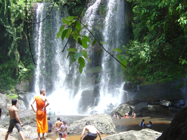
Kunlen mount is situated at north east of Angkor Complex about 50 Km, it takes approximately 2 hours drive up to the hill top with 487 meters height and plateau stretches 30 km long, it is opened for tourists in 1999 by private owned and charged for $20 toll per foreign visitors. The company developed road up to the peak. It is only possible to go up before 11 Am and only possible to come down after midday, to avoid vehicles meeting on the narrow road.


Bird Sanctuary at Prek Toal
The Biosphere covers 31,282 hectares at the northwest tip of the Tonle Sap Lake and plays host to species including Greater and Lesser Adjuncts, Black-headed Ibis, Painted Stork, Milky Stork, Spot-billed Pelican, Grey-Headed Fish Eagle and many more species. Of the three Biosphere core areas on the Tonle Sap Lake, Prek Toal is the most popular with birdwatchers. The best time to explore is the dry season between December to May when flocks of migratory birds congregate at Prek Toal. While the dry season progresses and the water recedes, the number of birds increase, but the tour to some of the more important viewing areas becomes more difficult. That's why requires to rent a small motorboat drives a long the stream for one hour to birds tower.
The Great Lake Tonle Sap & Floating Village

Five provinces circled the area of Tonle Sap Lake, more than three million of population inhabited around the bank of the Lake and 90% of them earn a living by catching fish and making agricultures. As you can see on the map of Cambodia It stretches across the northwest section of the country. The Lake is the largest fresh water in South East Asia. Its dimension changes depending on the monsoon and dry season. During raining season from June to October, the lake is filled by water flowing from the Mekong with 14 meters in depth and expands the surface of 10,000 square Kilometers. In dry season from November to May its size 3,000 square kilometers with two meters in depth and water flows out from the Lake to the Mekong, in and out flowing is the natural phenomenon occurrences. The flooded forest surrounding the edge of the lake is the best shelter and also very important for all kinds of fishes spawned and breeding babies. This lake providing many of biodiversities, over 300 species of fresh water fishes, as well as snakes, crocodiles, tortoises, turtles and otters. More than 100 varieties water birds including storks, pelicans, etc
The Lake is also an important commercial resource, providing more than half of the fish consumed in Cambodia. In harmony with the specialized ecosystems, the human occupations at the edges of the lake is similarly distinctive - floating villages, towering stilted houses, huge fish traps, and an economy and way of life deeply intertwined with the lake, the fish, the wildlife and the cycles of rising and falling waters
The lake located about 15 km south of Siem Reap town; you can make your journey from Siem Reap to Phnom Penh by express boat crossing the lake and dock at the village of Chong Khneas. Its takes only six hours, but this trip we may recommend you during Monsoon season. In dry season the boat sometimes stuck in mud because the water is low. There are several ways to see the culture and wildlife of the lake area depending on the amount of time you have and your interest.
Chong Khneas is the name of famous floating village at the edge of the lake. It locates at Southern part of Siem Reap town about 15 Km, and takes only 30 minutes by vehicles to the boat dock where there are always boats waiting for visitors. The boat trip through the floating village takes approximately two hours. You will explore the different of Khmer, Muslim and Vietnamese floating households and the floating markets, fisheries, clinics, schools, basketball course, pigsty and other boatloads of tourists.
Chong Khneas, was before very interesting, but now region is owned by private firm they did increasing prices and the area looks more commercial. The boat trip usually includes two stops: one at a touristy floating 'fish and bird exhibition' with a souvenir and snack shop, and the other at the very highly recommended Gecko Environment Centre, which offers displays and information introducing the ecology and biodiversity of the lake area.
Preah Ko Temple

This temple was constructed in 879 AD at the 9th century, to honor of the king maternal ancestor and also to dedicate to the God Siva. It was considered as the first temple had been erected in the Angkorian period. King Indravarman I who reigned in Khmer empire in 877-889, he build this monument to respect the spirit of parents, his grand parents, uncle and aunty. The name of Preah Ko meaning in Khmer language is “The Holy Bull”. The roof of the entry tower originally was constructed by the wood, at the wall was used the laterite or the lava stone, the doorway, lintels and pillars was used sandstone. Frame of the windows has decorated with five pieces of stone columns. The walkway was paved by laterite and flanking they decorated the stone lantern till the second section. At the second section of the temple, they designed the moonstone shape with lotus petal. But the structure was destroyed and poor condition remaining. You can see the libraries building on the both sides which build of laterite stone, and then there are three Bull Nandi lying down at opposite of the sanctuary. The central area is rectangular and consists of six brick towers arranged in two rows on a low platform. The tower to the front of the platform is larger than at the back, the middle one in the front are largest and set slightly back from other two. The three in the front row are for the male ancestor, such as the north tower was dedicated to Rudresvara, the protecting divinity of king Rudravarman. (Indravarman I’s maternal grandfather). In the middle was honor of his father king Prithivindravarman, and the south one was dedicated to Paramesvara the posthumous title of the founder of Khmer empire Jayavarman II. The three towers in row behind are smaller and dedicated to the principal queen of each king. Another significant fact is that these divinities could be variants of god Siva and goddess Uma, were symbolized of form of statues.
The base of central sanctuaries has three stairways along the eastern side. The sitting lion on the stairways guarding the temple. Each of six towers of the central sanctuaries was covered with stucco. Trace of the original can be seen either of the back row. The thicknesses of the stucco and sandstone motifs of false doors are most interesting. The columns which are octagonal considered the most beautiful of Khmer arts.
Prasat Bei
Prasat Bei was a Hindu temple dedicated to the Trinity gods, including Siva at the middle shrine, Brahma on the south tower and Vishnu on the north. This temple was built by the king Harshavarman I and his brother king Isanavarman II during the beginning of 10th century. This temple was designed in row by its three brick towers on a low platform of the sandstone. All the real doorways open to the east, but some lintels of these towers never completed its carving. We do not know exactly, if inside the towers were installed the Lingas or the statues. Prasat Bei means in the Khmer is “Three castles” has its entry towers on the east. The second entrance still remained the statues of Lingas, and beautiful carving at its balusters and lintels. But the first entrance before 1970 French restored, but never finished because by the war. We notice that during the excavation of the bottom of its foundation, they found three pieces of solid gold looked like the pieces of the brick. We also can see the broken bull Nandi statue crouching at the front of the building as well.
 |
| Kavan temple |
The Kravan temple was built in 921 by the minister Mahindharavarman to dedicate to the Brahmanism gods. This temple is a bit small by its looks, but it is worthy of it special brick sculpture which never had in the Khmer arts. The carving into the brick is a unique experience of the period of Angkor . The Kravan temple has five towers in row on a single platform. It is very unusual from the typical of the Khmer temples with five towers. Normally, the five towers such Angkor Wat, Pre Rup, East Mebon, Bakheng, for example the constructed with a shape of quincunx, but the Kravan temple, its towers all in row. This temple was restored by the French before 1970 but not finished because the war happened. Otherwise, each tower will have five layers as the same as the main tower. There is an entrance on the east, it shapes with across and its roof was wood. The foundation of the library or the home of the fire god on the south, and the most south you can see another foundation was a place of the rest house, which originally was wood using an the roof. The sculpture at the interior walls of the Kravan temple is depicting the Vishnu gods. On the southern wall is depicting the Vishnu reincarnation Vamana or Dwarf Brahmin priest who proclaimed the three worlds from the demon king Bali with his three steps, to ensure the gods possession. On the northern wall is depicting the Vishnu with his typical attributes ball, disc, club, conch, shell and Garuda. On the western wall is depicting the Vishnu appeared with eight arms, and holding the lotus flower. That’s mean he’s ready to help and to solve the problem may happen to all over the eight corners of the world. The inscription are on the doorway says especially about 250 slaves for serving and containing the Kravan temple. The most northern tower at its interior wall, also have the sculpture of the female goddess whose was Durga one of the nine wives of Siva god. We can tell as herself because by her attributes including disc, trident, fly wisk and lotus. The sculpture is the typical at the 10th century, as you can tell by her skirt designed with many pleats, and the feet turned to both side, we also notice that, the Phnom Bakheng temple sculpture are designed the same.
Bat Chum
The Bat Chum temple is a small temple its material were brick mostly and sandstone, and also laterite. Its location is about 400m to the east of the main road of the small circuit via Kravan temple. This temple was built by a Brahmin priest Kavindrimathana in the reign of king Rajendravarman II, at the middle of 10th century. The Bat Chum was dedicated to the Mahayana Buddhism. The temple of Bat Chum
The Pimean Akas temple was built to dedicate to Siva by the king Jayavarman V in the 10th century. This temple also restored by the king Suriyavarman I too. The Pimean Akas temple was served as a king private temple which they constructed in the middle of the royal palace. The materials of this temple were used in sandstone and laterite, which its base measured by 28 m x 35 m and its high is 12m. This temple designed with four stairways which one on the each side. The stairway on the west is very good condition by not too steep. But other three are so steep which just only the symbolism. The seated lions were guarded on the each projecting and at the corner you can see the elephant statues, but all of these statues were broken. During the Angkorian period, the called this temple that “The golden tower” rather than telling its name “Phimean Akas”. The Phimean Akas mean in Khmer is “The Sky Palace”. At inside the shrine, they installed the golden Linga which the symbol of the god king, and the golden Naga with nine heads which the symbol of prosperity of the kingdom.
According to Chou Ta Kuan a Chinese missionary who living in Angkor Thom for one year in the 13th century had mention in his book which one still existed today, as saying about The Pimean Akas temple as a holy place, that every eight o’clock at night the king climbed to the top of the golden tower of the temple for sleeping with the Naga woman, who emerged from the nine headed golden Naga statue in the shrine before he intercourse with his five wives or with his concubines. The king must do like this, otherwise believed that his kingdom and himself would get prosperity and healthy. On the contrary, which the king arrived and had not met the woman Naga in the shrine of Phimean Akas, believed that the king would face the problems and the whole kingdom would be bad sign, and then the king invited the royal astrologer to figure out what would be happened. He also mention that the Phimean Akas was prohibited for the public, except only the sovereignty could used it as a very holy place for prosperity of the kingdom.
Takeo

The Ta Keo temple was constructed by king Jayavarman V in the year 1000, for dedicate to God Siva. This temple was considered as the first temple using the material of sandstone completely. Because we notice that before this period of the Takeo, most the monumental structures were used more brick and laterite. Thus, the Takeo temple was began to used the big block of sandstone and it’s also the huge building in the Angkor area. But The Ta Keo temple was unfinished even this temple we knew by the inscription telling us that was built another king in the 11th century by king Suriyavarman I. The reason that made this monument never completed, according to the inscription wrote in the doorway saying about the lightning struck the tower, that’s it’s never finished because the king thought “This is the sign from the heaven, it was probably the gods did not want to stay in this location, for bad omen”. We also notice that the type of this sandstone were brittle. That was hard to carve. This is another reason, that’s why they decided to stop to build any more. From Takeo temple is the method to tell the visitors to understand, the way to carve for decoration in the temple, which they built everything first, and then they made the carving later.
The Ta Keo temple also has another name in Sanskrit is “Hemasringagiri” which mean “The mountain with golden peaks” under the original period of Jayavarman V, and when the king Suriyavarman I took effort to restore, he was dedicated one of the shrine as called “Yogisvara Pandita”. Ta Keo face to the east and having a walkway about 50 m long with its size is 255m x 195 m, and 22 m high from the ground level. The five towers of Ta Keo was the shape of quincunx, which each of the tower has open the door in each direction. When you reach at the top, you also can see the tip of Angkor Wat emerge from the jungle as well. Sometime for watching the sunset is one of the best.
The Khleangs
The Kleangs were not served as a temple; they seem served as the storehouse for keeping the material for the ritual ceremony needs. The Kleangs mean in Khmer “storehouse of royal treasure” according to its name, and to the unusual building designed extensive north to south rather than crossing its length from east to west as the Khmer religious building always had done. We know by the steles tells us that, the north Kleang was constructed under the reign of the king Jayaviravarman at the end of the 10th century, while the south Kleang was erected by the king Suriyavarman I and early 11th century. The location of Kleangs are opposite of the royal palace, which each of them measure 40m x 5m. The both building are unfinished, but the north one is more details of decoration. The style of Kleangs applied to Takeo and Phimean Akas, especially by its beautiful columns.
Preah Pithu

The Preah Pithu temple was designed separation in group, which there are five monuments altogether. The group of these shrine were built some of them dedicated of Hindu, and some dedicated to the Buddhist. These monumental temple were erected under the reign of king Suriyavarman 2, at the beginning of the 12th century. Although they can not find any inscription to identify the date, and the king, but the scholars agreed that the group of this small temple was probably constructed by the king Suriyavarman 2, according to its style of architecture and carving. The group of Preah Pithu was so ruined state, but if we have time, it is so interesting to see the relief of the lintels which depicting the life of the Hindu gods and Buddha episode. This group you can see them including, the Kleangs, Sour Prat and Vihear Prampi Lveng. There is the moat surrounded these shrines, and to the east, it still remained the elephants statues.

The small temple was completed restoration by Mr. Groslierin in 1960. The location of Thommanon is about 200 m to the east of the victory gate of Angkor Thom and on the road of small circuit. Thommanon temple was built in the reign of king Suriyavarman 2 in the early of the 12th century. As the same as the Preah Pithu temple Thommanon they only guesses by the date, as they were not able to find any inscription to identify its date. It was a Hindu temple and its compound is 45m x 60m. There is a moat surrounding the temple, and one library building or the home of the fire god (Agni) which its style is very similar of the library of Banteay Srei. Even it is small, but Thommanon temple there are the beautiful Apsaras with some of them are so well preserved, especially at the corners of the structure. There are two entrances of this temple, which one on the east and another one on the west. At the pediments of this temple, there still good condition, which depicting the Hindu myths, including Ravana shacking the mountain Kailasa, Krisna holding the mountain Govendhana, Siva meditating at Himalaya, Rama with his wife Sita etc.